We had an early breakfast and broke camp. It was only about an hour before we reached the Runcurakay ruins, at 3,800 meters above sea level. This is a circular, walled complex with interior niches. We had a short briefing on what was believed to be their function - a small place for rest, guardpost and worship place.
We continued up and encountered the first real insect invasion of the trip. There were small gnats (sometimes called sandflies) which were biting any exposed skin. I didn't take time out to put on any repellant, and instead I would swap them when I felt them on my legs. This proved to be a big mistake, when later I found I had about 30 itching bite marks on each of my legs.
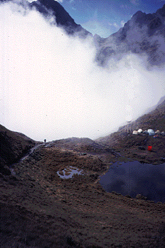
Before the second pass, we climbed by two small alpine lakes, and there were campsites beside each of them.
In a short while, we reached the second pass, and were basking in warm sunshine and taking in the new view to all sides. The altitude here was about 3,800 meters (12,300 ft) We met a large group of Australians and New Zealanders who were having a good time.
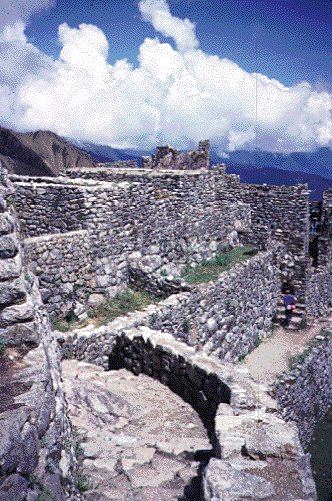
From here, the trail was mostly downhill, and in a few hours we approached Sayacmarca ("Dominant Town"). This complex lies at 3,600 meters above sea level and was about 5 km from the Runcurakay ruins, which takes 2 hours.. This ruin was situated on the tip of a very prominent ridge. We climbed the narrow stairway and explored the ruins for about an hour. I thought this was a very interesting ruin, because a main feature was a large alter to worship the highest mountain in the Cusco area - Mt Veronica, which could be viewed from this site.
The trail descent went into a very dense "cloud forest" / jungle and included a version of bamboo that the Incas used in their building construction. We crossed to the other side of the valley, with the valley on our left side. Much of the trail showed superb engineering, built on the side of a steep hillside, on top of Inca stonework. Often there was a shear drop to the left-- a 30 to 50 foot drop. In a little while, we came to the Inca Tunnel, named because the Incas expanded it from a small tunnel to a 8 meter tunnel to continue the trail on this steep hillside. It actually got VERY dark in the middle section of this tunnel!
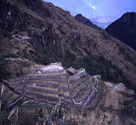
After a level hike, we reached the third pass on a high grassy mound, where our group and other groups were resting. From here, we looked directly down to the Phuyupatamarca ruins. The rectangular structures along one side were baths, which were fed from a spring. They believe the highest baths were reserved for the nobles. In the distant mountains, we could see burned areas, which were from the recent brushfires (early September, 1997) which had reached the Machu Picchu area.
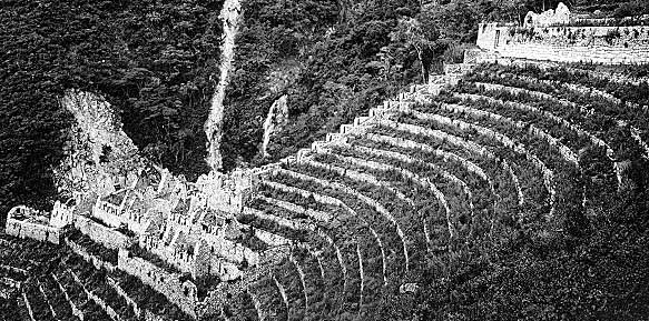
We descended down and beyond the Phuyupatamarca ruins. The trail was composed of thousands and thousands of Inca stone steps. Soon we could see an Inca agricultural terrace in the distance. The view was marred by electric transmission lines only a few meters away from the ruins. (I had heard that the terraces were discovered about 5 years after the transmission lines were put in.).
In about 3 kilometers, we soon arrived at the Hostel Machu Piccu (sometimes described as the Wisayhuayna Visitors Center)-- reachable only by hiking the trail. Here you can buy basic hostel rooms, food and drinks or use the bathrooms. It was a nice warm, sunny afternoon. We celebrated by buying a few cold beers on the outside patio and basking in the sunshine. Just before sunset, our group traveled 5 minutes down the trail to another Inca ruins -- Wińya Wayna "forever young".
Old photo from a book, showing the Wińya Wayna ruins shortly after initial excavation
The ruins were set in a concave, semicircle pattern. The buildings were divided up into four sectors which are: the agricultural sector with many terraces, the religious sector, the fountain sector and the residential sector.
The three Brazilians and I lingered around the ruins and explored more until it got dark. I noticed that they were commenting on the ruin's stonework and construction to themselves, but they were struggling to find the correct words in English. I asked them why they didn't just talk to themselves in Portuguese? Why stuggle with a foreign language to talk between themselves? They said that they were traveling internationally, and it was better to talk in English while on vacation.
Later, we had a semi-civilized indoor dinner in the annex building slightly downhill from the hostel, followed by more cold beers. The building was very loud and overflowing with people from dozens of countries, with the people in their sleeping bags on the floors trying to get to sleep early competing with the people who were celebrating and drinking beer after beer.
Our group was celebrating. We knew the hard hiking was behind us and we were only an easy 2 hour hike from Machu Picchu.